Dr. Geoffrey McCafferty


Field investigations were conducted in 2000, and then from 2003-2005. Seven loci were investigated.
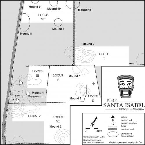
[site map courtesy of Larry Steinbrenner]
Field investigations proceeded in three stages. Upon selecting an area for investigation, it was gridded using a common datum point. Shovel tests were then dug at 10 m intervals throughout the locus. These averaged about 50 cm in diameter and reached about 1 m in depth. For example, Locus I was tested during the 2000 field season, resulting in this pattern:
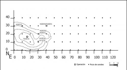
Shovel testing proved to be a very effective way of identifying subsurface artifact densities, with collections ranging between 0 and over 1000 artifacts in test pits. The greatest concentrations were consistently on the low mounds themselves, while empty areas between mounds indicate that ''yard middens' were not used and that. depositional patterns remained relatively stable. The highest concentration of artifacts was found on Mound 5.
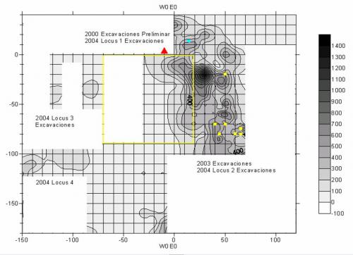
Following the shovel testing stage, individual stratigraphic units were used to investigate 'hot spots', identified as high artifact concentrations or subsurface anomalies. For example, in 2000 a test pit stopped at a solid layer of broken pottery, a 1 x 1 m unit adjacent to the test pit revealed a pot break on a living surface.
The final stage in the field investigations was the excavtion of broad horizontal exposures, termed "Operations." These were generally located with the exploratory 1 x 1 units had revealed potential living surfaces, or other features.