Dr. Geoffrey McCafferty


By Geoffrey McCafferty (2010)
Field investigations were conducted at the site of El Rayo during the summers of 2009 and 2010. El Rayo (GR39) is located at the tip of the Asese peninsula in Lake Nicaragua (also known as Lake Cocibolca), just south of the modern city of Granada (Figure 1). Investigations were funded by a grant from the Social Sciences and Humanities Research Council of Canada as the second year of the Proyecto Arqueologico Granada, Nicaragua.
El Rayo had been identified as a Sapoa and Ometepe period site during Silvia Salgado's Granada regional survey (Salgado 1996). The area was formed by volcanic activity that produced numerous natural hills of basalt boulders; the peninsula is surrounded by hundreds of small islands that were created by the same process. Low lying areas of the site also featured light color soil that may be the result of volcanic mudflows (lahars) that occured about 500 CE. Since the archaeological deposits rest on top of this layer the occupation post-dated the lahar deposits (Figure 2).
Excavations took place in three loci: Locus 1 was a cemetery that had been exposed by recent road construction; Locus 2 was a residential area with high concentrations of domestic refuse; and Locus 3 was a second cemetery. Following initial investigations in 2009, a brief field season in 2010 returned to continue excavations at Loci 1 and 2, and in the process identified additional mounds at a fourth area of the site.
Plans are currently underway to continue excavations as a field school through the Institute of Field Research, beginning in summer 2015.
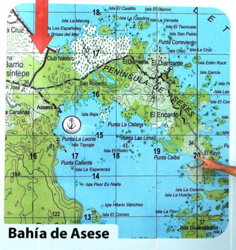
Figure 1: Map of Asese peninsula indicating location of El Rayo
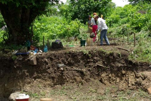
Fiugure 2: Locus 1 roadcut showing possible lahar deposit beneath cultural level